Community Map
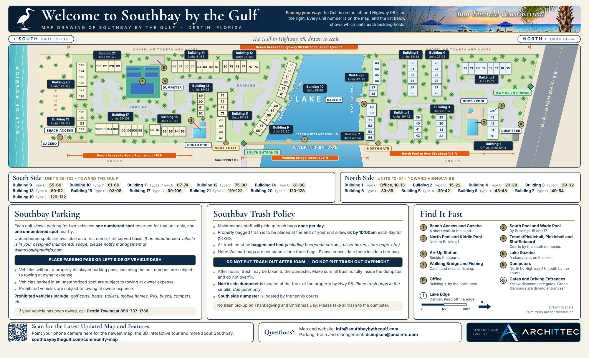
One accurate map of the whole community, drawn to scale from the Gulf to Highway 98.
Interactive 3D Map
Drag to turn the model, scroll or pinch to zoom, and tap any unit. Use the place buttons to jump to the pools, courts, lake gazebo and beach, or press Arrival Tour for a guided flight from Highway 98 to the Gulf.
Guest and Owner Map
Every unit number, both pools, the courts, beach access, gates, dumpsters and parking, with walking distances. Print it on legal paper (8.5 x 14 in), landscape.
Good To Know
About This Map
Building outlines are traced from county aerial imagery to within about 2 ft. Unit lines are equal divisions of each building, not a survey. Building heights in the 3D model are placeholders. Gate, entrance and dumpster positions are approximate. Trees are for decoration. Questions about the map? Email info@southbaybythegulf.com.